| Glaciology |
|
|
A NEW BATHYMETRIC PERSPECTIVE OF THE BAKER-MARTINEZ FJORD COMPLEX
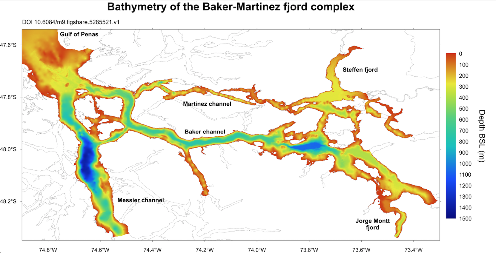
Andrés Rivera, a researcher of the CECs Glaciology Laboratory, together with an international team of experts, built a bathymetric map of the Baker-Martinez fjord complex in the XI Region of Aysen. It was done with an echo sounding system survey and SHOA (The Navy Hydrographic and Oceanographic Service) references of nautical cartography. The data was processed and interpolated to obtain a 15-meter spatial resolution model for the entire fjords and channels network.
In this way, it was established that the Messier channel maximum depth is 1405 m (~ 48°04' S) while the maximum depth of the Baker channel is 1075 m. This channel connects to a fjord where the Jorge Montt glacier of the Southern Ice Field ends, the largest in the area, which has receded approximately 22 km since 1898 (Rivera et al., 2012).
Dr. Rivera participated in the measurement and analysis of this fjord, which reaches depths of ~400 meters in front of the Jorge Montt, which detaches large amounts of icebergs in the fjord: "Knowing the bathymetry of the canals and fjords located between the two Patagonian ice fields is tremendously useful information for research on calving glaciers and for the interaction and mutual influence between the ice fields and the ocean.“
Refs.:
Piret, Loic; Bertrand, Sebastien; Vandekerkhove, Elke; Harada, Naomi; Moffat, Carlos; Rivera, Andres (2017): Gridded bathymetry of the Baker-Martinez fjord complex (Chile, 48°S) v1. figshare. https://doi.org/10.6084/m9.figshare.5285521.v3 Retrieved: 19:22, Nov 14, 2017 (GMT)
Rivera, Andrés; Koppes, Michelle; Bravo, Claudio, Aravena, Juan Carlos (2012): Little Ice Age advance and retreat of Glaciar Jorge Montt, Chilean Patagonia. Climate of the past, 8, 403-414 https://doi.org/10.5194/cp-8-403-2012
|